


Xega, a new flight planning platform that includes a maintenance tracking and aeromedical component, has opened its Founders Beta testing, which it is limiting to 100 pilots. Active beta testers who use the platform and contribute feedback earn free lifetime access when Xega launches publicly.
Flight Planning
New Tools Added to Garmin Pilot Web
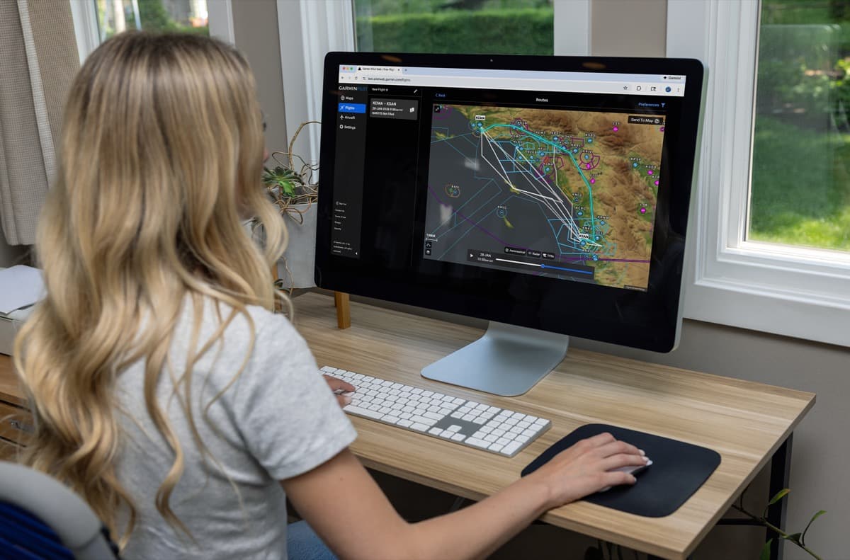
New routing tools join a new graphical editing feature to make flight planning easier for pilots.
iFlightPlanner Unveils Rebuilt Digital Logbook with Seamless ForeFlight Import
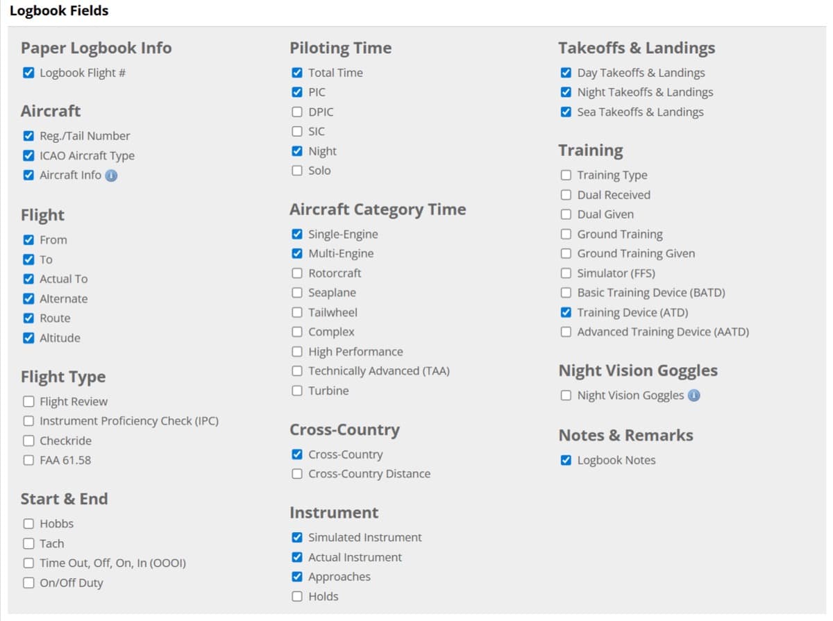
To make switching easier, iFlightPlanner Premium members can import their ForeFlight logbook using a direct, field-matched process.
A Flight Planning App Built For Today

Famous for his around-the-world flight and YouTube channel, Matt Guthmiller has launched 8Flight, a next-generation EFB. Designed to rival market leaders, the app offers real-time AI weather, offline planning, and streamlined flight intelligence for a modern cockpit experience.
Pilot draws The Grinch in the sky
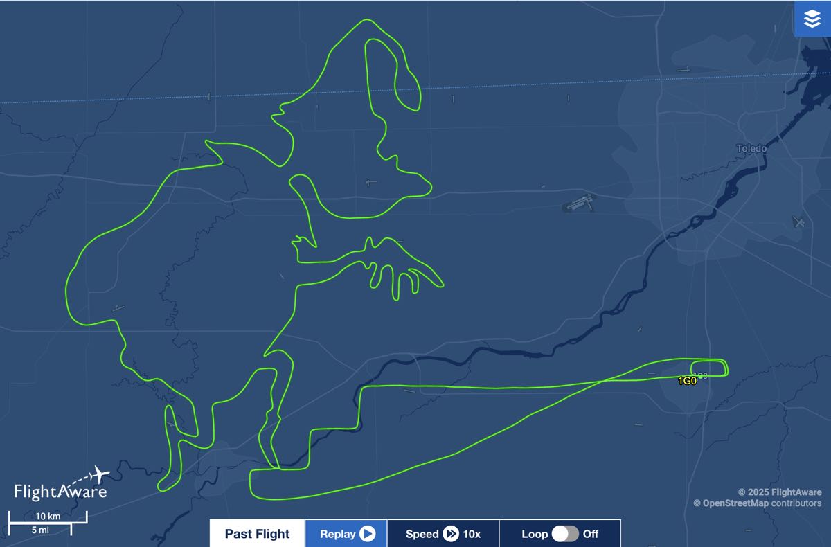
The same pilot, or at least the same aircraft, completed both this aerial drawing as well as the Nativity scene on Dec. 15.
Pilot creates Nativity scene in skies above northern Ohio
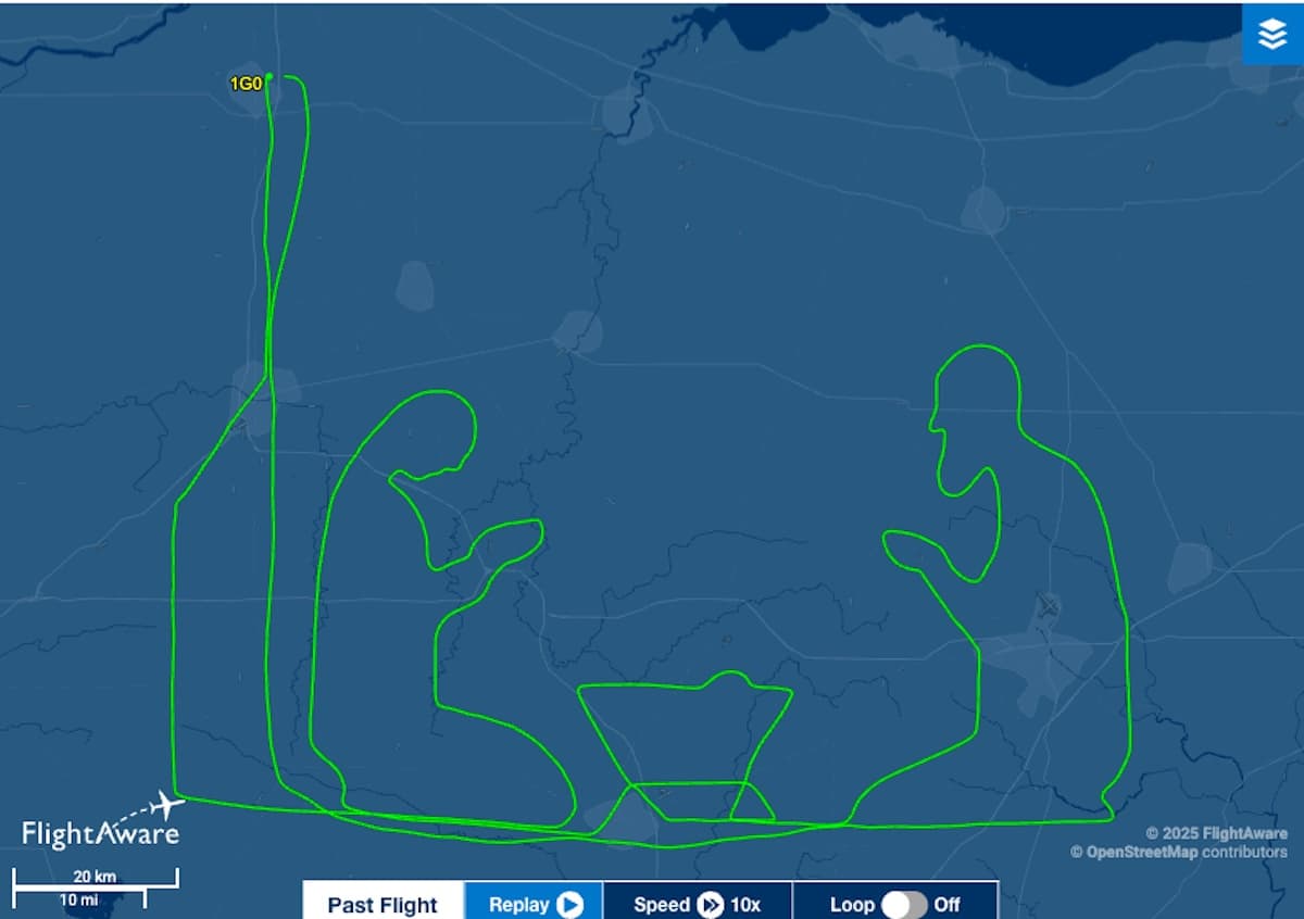
According to FlightAware, the Piper Cherokee pilot took off from Wood County Airport in Bowling Green, Ohio, at 5:36 p.m. During the flight, which covered 500 miles and took five hours, the pilot sketched out Mary, Joseph, and the baby Jesus in a manger.
Garmin SmartCharts adds Graphical NOTAMs overlay to alert pilots of surface closures
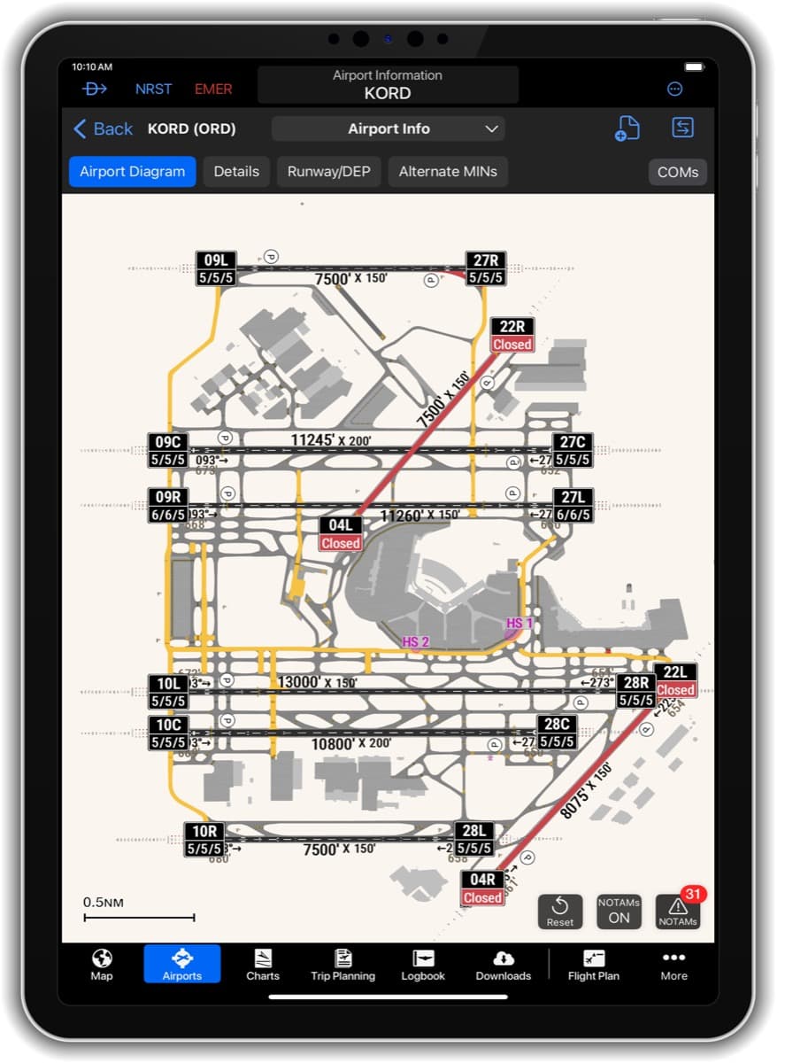
The new Graphical NOTAMs overlay, when selected “On,” will depict active runway, taxiway, and ramp closures, as well as conditional closures. Additionally, current field condition (FICON) codes will appear on the runway label, allowing pilots to see the runway conditions while viewing the airport diagram.
New app solves one person’s problem
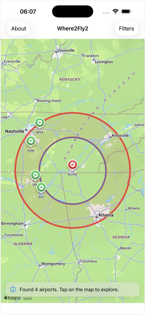
“I even used the app while traveling, even when I wasn’t flying, to find local airports to visit,” said Michael. “But they stopped developing it.”
New app helps pilots find airports to fly to
New iOS app Where2Fly2 helps pilots find airports by distance, runway length, and surface type using official FAA data.